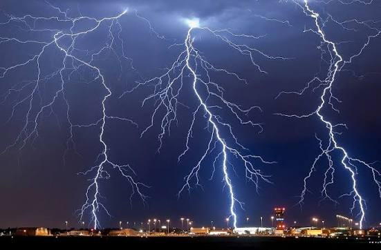
Thunderstorms may be more than spectacular displays of lightning and sound. Scientists have discovered that powerful thunderclaps can send vibrations into the ground—and those natural signals can be used to investigate what lies beneath Earth’s surface.
In a recent study, researchers used intense sound waves generated by thunder to create maps of shallow underground geology beneath a large U.S. university campus. The work offers an unusual new way to study the ground without relying entirely on conventional seismic sources.
What are “thunderquakes”?
The term “thunderquakes” may sound like a new type of earthquake, but that isn’t what scientists mean.
Instead, it describes ground vibrations produced when powerful thunderclaps release acoustic energy. When the sound waves reach the Earth’s surface, part of that energy can travel into the ground.
Sensitive scientific instruments can detect these vibrations.
Researchers can then analyse how the waves move through different underground materials to learn about the structure of the shallow subsurface.
How can thunder reveal what is underground?
Seismic waves do not travel through every material in exactly the same way.
Their speed and behaviour can change depending on whether they are passing through loose soil, sediment, weathered rock or harder geological layers.
Scientists can record the vibrations produced by thunder and examine these changes. By combining measurements from multiple sensors, they can build an image of the underground structures responsible for the observed signals.
In the recent research, this approach was used to map shallow geology beneath a university campus.
Turning a natural storm into a scientific experiment
Traditional seismic surveys often require researchers to deliberately generate vibrations and then measure how those waves travel through the ground.
Thunderstorms provide something different: a naturally occurring source of powerful sound energy.
Instead of creating every signal themselves, researchers can take advantage of storms when conditions are suitable.
This could provide an interesting additional tool for studying shallow geological structures, particularly in places where conventional surveys are difficult or expensive.
Why shallow underground geology matters
Understanding the first layers beneath Earth’s surface is important for many reasons.
Scientists and engineers need information about underground materials when studying:
- soil and rock structures;
- groundwater systems;
- geological boundaries;
- construction sites;
- earthquake-related hazards; and
- other shallow subsurface features.
Better maps of these layers can help researchers understand how the ground behaves and how different geological materials respond to vibrations.
Thunder is powerful—but not perfectly predictable
There is an obvious limitation to using thunderstorms as a scientific tool: scientists cannot control when or where the strongest thunderclaps will occur.
The strength, location and characteristics of thunder vary from storm to storm. Researchers therefore need sensitive instruments and carefully designed methods to separate useful signals from background noise.
That means thunder-based seismic mapping is unlikely to replace established geological survey techniques on its own.
Instead, the research demonstrates that a natural phenomenon normally regarded as weather noise can contain useful information about the planet beneath us.
A new way to listen to Earth
The idea is part of a broader scientific approach: finding useful information in signals that already exist in nature.
Earth constantly produces vibrations—from ocean waves and earthquakes to human activity and atmospheric events. Scientists increasingly use sensitive instruments to capture these signals and extract information about hidden geological structures.
Thunder adds another source to that growing collection of natural signals.
Could this method be used more widely?
More research will be needed to determine how broadly thunder-generated vibrations can be used for underground mapping.
The technique may be particularly useful for shallow geological investigations, but researchers will need to test it under different environmental and geological conditions.
It also demonstrates how advances in sensors and data analysis can turn seemingly ordinary natural events into scientific measurements.
From thunderstorm to underground map
A thunderclap normally lasts only a few seconds before disappearing into the distance. But the vibrations it produces can carry information about the ground.
By capturing and analysing those signals, scientists are showing that a storm can become an unexpected research instrument.
The discovery does not mean thunderstorms can replace earthquakes or conventional seismic surveys. Instead, it opens an intriguing possibility: the next time thunder rolls across the sky, scientists may hear more than just a storm—they may hear clues about what is hidden beneath Earth’s surface.