
The India Meteorological Department (IMD) has issued heavy to very heavy rainfall alerts for parts of Andhra Pradesh and Odisha following the intensification of a low-pressure system over the Bay of Bengal into a depression.
As of September 21, 2026, the well-marked low-pressure area strengthened into a depression and lay centred over the west-central and adjoining northwest Bay of Bengal, approximately 310 km southeast of Puri (Odisha), 390 km east-southeast of Kalingapatnam (Andhra Pradesh), and 470 km east of Visakhapatnam.
The system is very likely to move west-northwestwards and intensify into a deep depression over the west-central and adjoining northwest Bay of Bengal within the next 24 hours. It is expected to cross the north Andhra Pradesh–south Odisha coasts between Visakhapatnam and Gopalpur as a deep depression during the night of September 23 to the early hours of September 24.
Rainfall Warnings
Andhra Pradesh: Orange alerts for September 22 in northern districts including Srikakulam, Parvathipuram Manyam, Vizianagaram, Visakhapatnam, Alluri Sitharama Raju, Anakapalli and Kakinada for heavy to very heavy rainfall.
Red alerts issued for September 23 and 24 in Kakinada, Dr. B.R. Ambedkar Konaseema, East Godavari, West Godavari, Krishna, Eluru and Yanam for extremely heavy rainfall at isolated places. Other coastal and northern districts remain under orange alert. Rayalaseema districts have no major alerts.
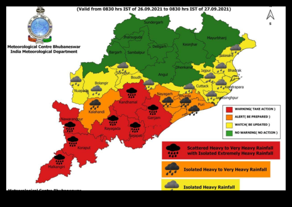
Odisha: Red alerts for extremely heavy rainfall (over 20 cm) in Kandhamal, Gajapati, Ganjam and Puri on September 23, and in Kalahandi, Kandhamal and Rayagada on September 24. Orange and yellow alerts cover several other southern and coastal districts. The state government has placed multiple districts on high alert.
Isolated extremely heavy rainfall is also possible over south Odisha and north coastal Andhra Pradesh on September 23–24. Heavy to very heavy rain is likely to continue affecting parts of Telangana, Chhattisgarh and neighbouring regions in the following days.
Wind and Sea Conditions
Squally winds of 55–65 kmph, gusting to 75 kmph, are expected over the west-central and adjoining northwest Bay of Bengal and along the south Odisha–north Andhra Pradesh coasts. Rough to very rough sea conditions are likely. Fishermen have been advised not to venture into the affected sea areas until September 24.
District administrations in both states have been directed to monitor reservoirs, clear drainage channels, prepare for waterlogging and landslides, and ensure readiness of relief measures. Residents in coastal and low-lying areas are urged to stay updated with official IMD bulletins and follow local administration advisories.
The system is associated with the ongoing southwest monsoon and is currently not expected to intensify into a cyclonic storm, according to IMD assessments.Stay safe and monitor official updates from the India Meteorological Department (mausam.imd.gov.in) and state disaster management authorities.